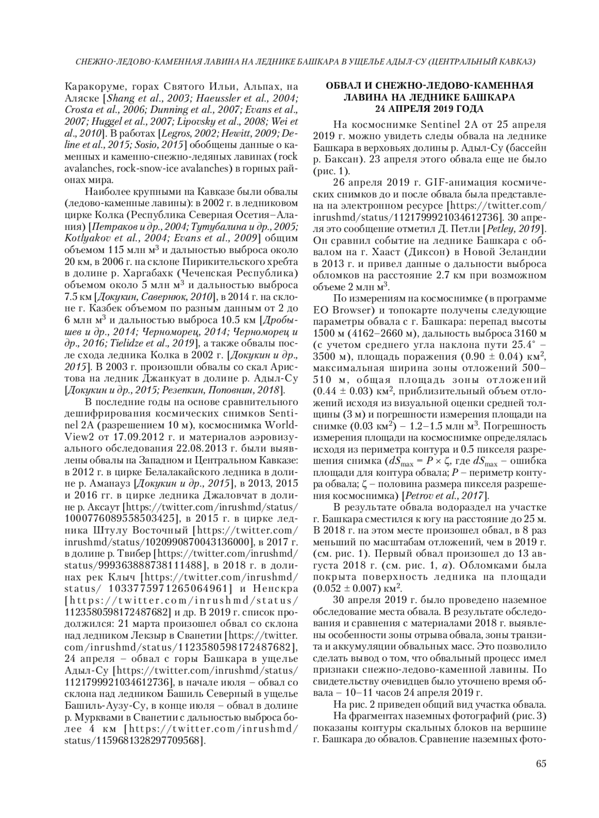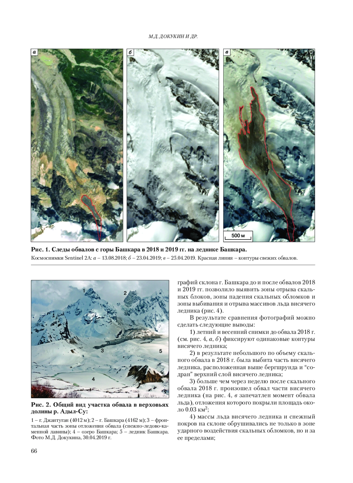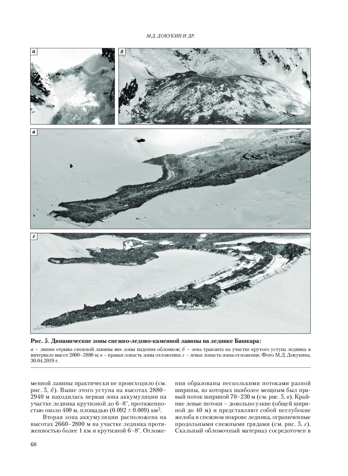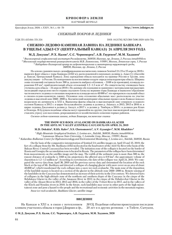
На основе сравнительного дешифрирования космических снимков Sentinel 2A 23 и 25 апреля 2019 г. выявлен факт обвала с горы Башкара (4162 м), расположенной в верховьях долины р. Адыл-Су (бассейн р. Баксан, Центральный Кавказ). Зона зарождения обвала находится на границе России и Грузии, зона аккумуляции - в России. По измерениям на космоснимке и карте определены параметры обвала. Ширина зоны отложений составила более 500 м, дальность выброса обломков - 3160 м (в проекции), площадь поражения 0.9 км2, приблизительный объем отложений 1.2-1.5 млн м3. По свидетельству очевидцев была уточнена дата обвала - 24 апреля 2019 г. По данным обследования и сравнения с материалами предыдущих экспедиций определено место отрыва скального блока на вершине горы Башкара и выявлено обрушение части висячего ледника со снежным покровом на площади около 40 000 м2, что превратило скальный обвал в снежно-ледово-каменную лавину. Основная зона отложения обвальных масс расположена на участке ледника в высотной зоне 2660-2800 м. Космический мониторинг обвальных процессов на Кавказе показал возросшую их активность в XXI в. Выявлены факты обвалов в высокогорной зоне северного и южного склонов Кавказа: в 2012 г. в цирке Белалакайского ледника в долине р. Аманауз, в 2013, 2015 и 2016 гг. в цирке ледника Джаловчат в долине р. Аксаут, в 2017 г. в долине р. Твибери, в 2018 г. в долинах рек Клыч и Ненскра. В будущем подобные обвалы могут произойти на других участках высокогорной зоны и представлять угрозу для населения, рекреационного и хозяйственного освоения горных районов.
On the basis of the comparative interpretation of Sentinel 2A satellite images on April 23 and 25, 2019, the fact of a collapse from the Mt. Bashkara (4162 m) located in the headwaters of the Adyl-Su River (the basin of the Baksan River, Central Caucasus) has been revealed. The initiation zone of the collapse is located on the border of Russia and Georgia; the accumulation zone is located in Russia. The parameters of the collapse have been determined from measurements on the satellite image and the map. The width of the sediment zone is more than 500 m, the runout distance of avalanche is 3160 m (in projection), the affected area is 0.9 km2, the approximate volume of deposition is 1.2-1.5 million m3. According to eyewitnesses, the date of the collapse was April 24, 2019. We compared the survey data from April 30, 2019 and the previous survey data and determined the location of the rock block at the top of Mt. Bashkara and detected a collapse of a hanging glacier with snow cover on an area of about 40,000 m2, which transformed the rock collapse into a snow-ice-rock avalanche. The main zone of the deposition of the landslide masses is located on a section of the glacier in the altitude zone 2660-2800 m. Remote sensing of the landslides in the Caucasus has demonstrated an increase of their activity in the 21st century. We detected facts of collapses in the high-al titude zone of the northern and southern slopes of the Caucasus: in the cirque of the Belalakaya Glacier in the valley of the Amanauz River in 2012, in the cirque of the Dzhalovchat Glacier in the valley of the Aksaut River in 2013, 2015 and 2016, in the valley of the Tviberi River in 2017, and in the valleys of the Klych and Nenskra rivers in 2018. In the future, such landslides may occur in other parts of the high-mountainous zone and pose a hazard to the people and the recreational and economic activities in the mountain regions.
Предпросмотр статьи